When most people think of drone photography, they picture dramatic aerial shots that “look cool.” And yes — great drone imagery does look impressive. But for real estate, construction, inspections, and commercial projects in San Diego, drone photography serves a much more practical purpose.
Drone imagery answers questions that ground photos simply can’t.
Whether you’re marketing a property, documenting a project, or assessing a structure, aerial photography provides clarity, context, and perspective that saves time and improves decision-making.
Here’s what drone photography reveals — and why it matters.
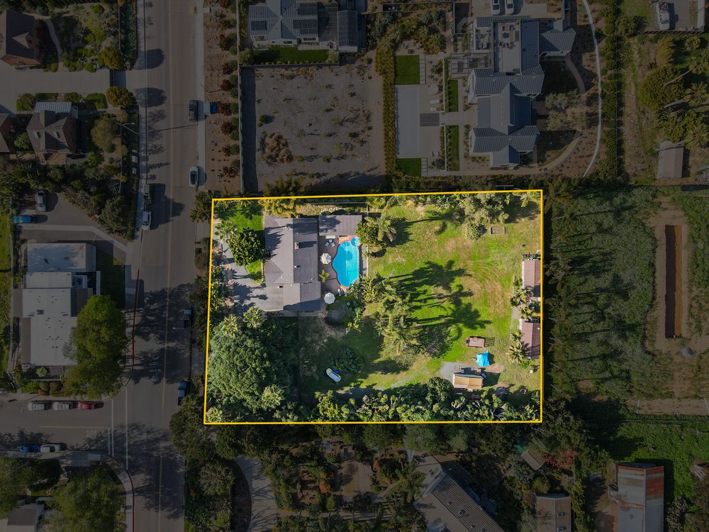
- Lot size and boundaries
- Relationship between structures
- How much usable space actually exists
This is especially important in San Diego, where properties often vary dramatically in size, elevation, and layout — even within the same neighborhood.
A single aerial image can communicate what 10 ground photos can’t.
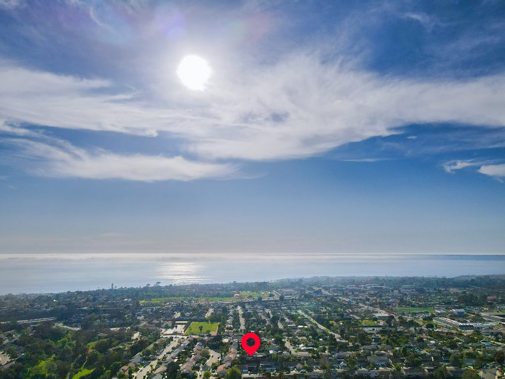
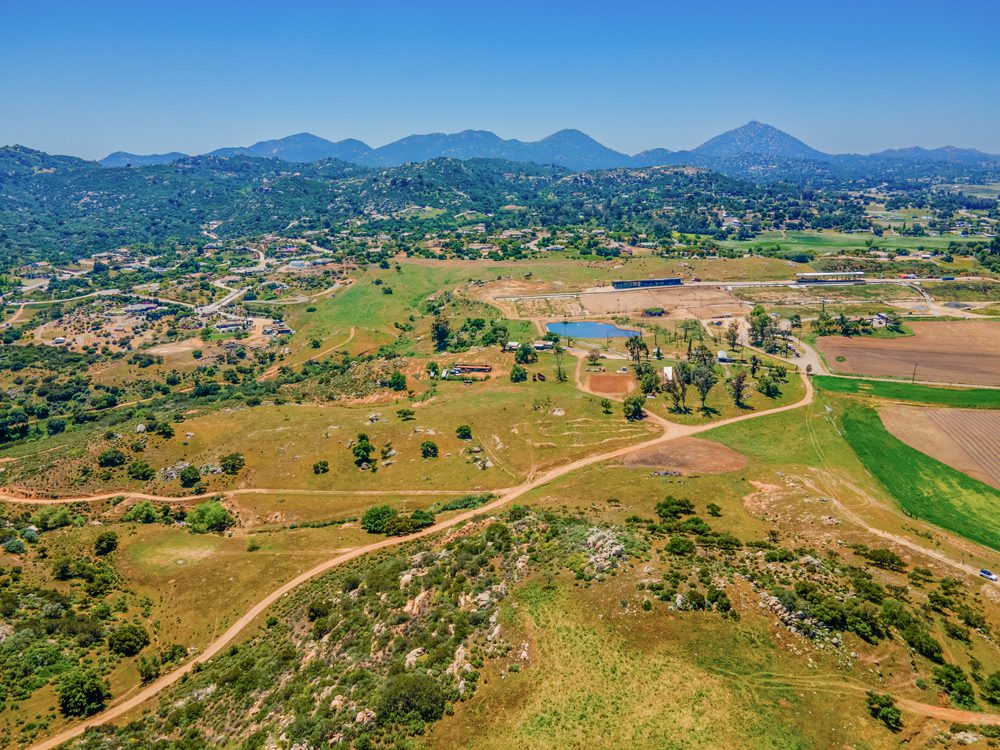
2. Location, Surroundings, and Context
One of the biggest advantages of drone photography is showing where a property sits — not just what it looks like.
Drone imagery can clearly show:
- Proximity to the ocean, bays, or canyons
- Nearby roads, access points, and parking
- Surrounding homes, buildings, or open space
- Distance to landmarks, commercial centers, or amenities
For out-of-town buyers or investors, this context is invaluable. It removes uncertainty and builds confidence faster.
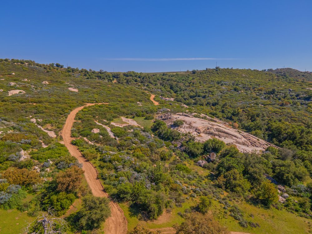
3. Elevation, Terrain, and Slope
San Diego is not flat — and that matters.
Hillsides, coastal bluffs, and uneven terrain are difficult to understand from ground level. Aerial imagery makes elevation changes immediately clear, helping viewers understand:
- Buildability and layout
- Drainage and grading
- Viewsheds and sightlines
- Access challenges or advantages
This is especially useful for land listings, development planning, and inspections.
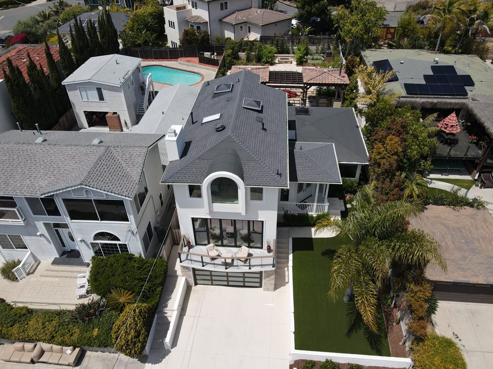
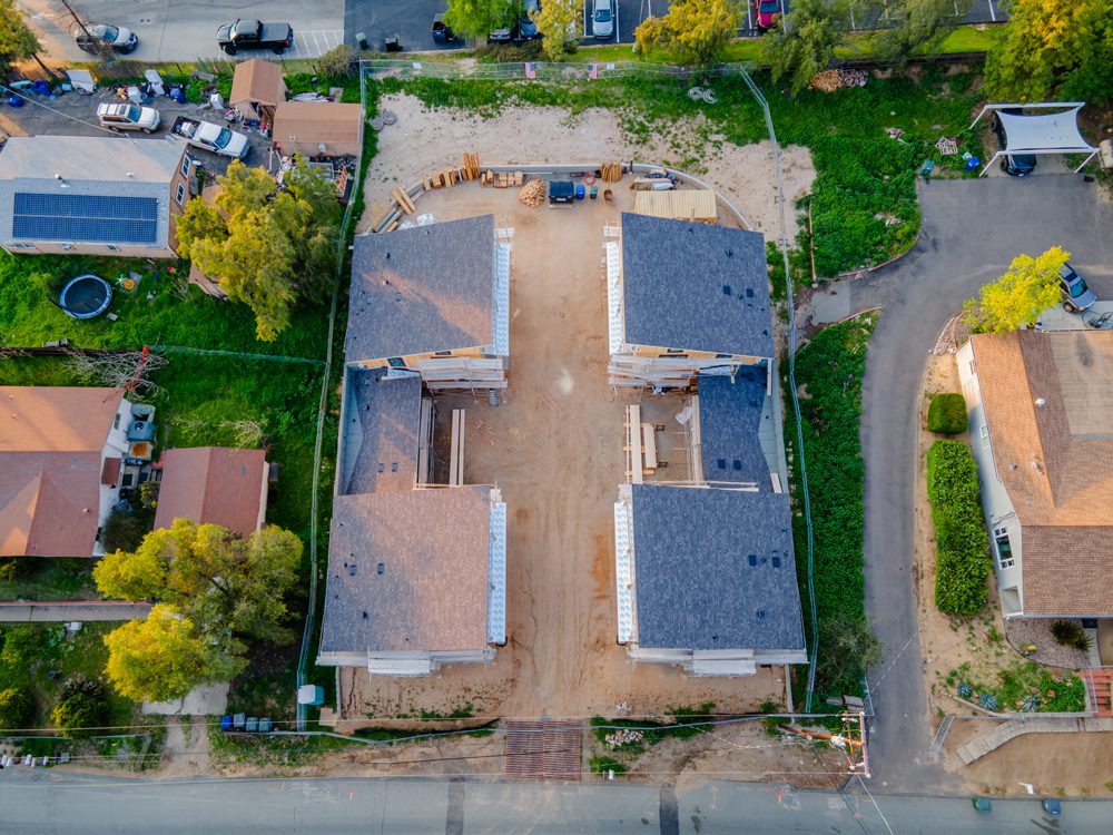
4. Roofs and Structural Overview
Ground photos rarely provide a clear view of rooftops or upper elevations. Drone photography allows for:
- Clean, unobstructed roof views
- Safer inspection imagery without ladders or lifts
- Documentation of condition, layout, and materials
For inspections, insurance documentation, and property assessments, aerial perspectives are often more efficient and less disruptive.
5. Access Points and Flow
How do people, vehicles, or equipment actually move through a site?
Drone imagery helps show:
- Driveways and entry points
- Parking layout and flow
- Loading areas and access roads
- Relationship between buildings and infrastructure
This is especially valuable for commercial properties, construction projects, and larger residential estates.
6. Progress Over Time
For construction and development projects, consistency matters.
Drone photography allows for:
- Repeatable angles across multiple visits
- Clear documentation of progress
- Visual reporting for stakeholders and investors
Aerial progress documentation creates a reliable visual record that ground photography can’t match.
Drone Photography Isn’t a Gimmick — It’s a Tool
When used intentionally, drone photography becomes a problem-solving tool, not just a visual add-on.
The key is knowing:
- What to capture
- When to fly
- How to frame images for clarity and purpose
That level of precision comes from experience, planning, and creative understanding — not just owning a drone.
With over 30 years of experience in photography and videography, I approach drone work with the same focus on composition, storytelling, and clarity as traditional visual media — combined with the technical and regulatory knowledge required for professional aerial work. I am FAA-certified, insured, and operate with safety and compliance as a foundation, not an afterthought.
Looking for Professional Drone Photography in San Diego?
If you’re marketing a property, managing a construction project, or need reliable aerial imagery for inspections or documentation, working directly with a local drone pilot makes a difference.
I provide professional drone photography and video services throughout San Diego, delivering the same high standards as national platforms — with the advantage of local knowledge, creative expertise, and direct communication.